

Shoreline armoring of Michigan’s Lake Michigan coast increased fivefold during the latest period of high water
August 28, 2025 - Diane Huhn
With Labor Day fast approaching, many Lake Michigan beachgoers will lament the unofficial end of summer. While they have enjoyed average to slightly below-average lake levels this summer, many Michiganders will remember a very different scenario that began playing out just a little over a decade ago. Starting in 2014, Lake Michigan, like the other Great Lakes, experienced increasingly high water levels, peaking in 2020. As water levels and wave energy increased during this time period, so did beach, dune, and bluff erosion.
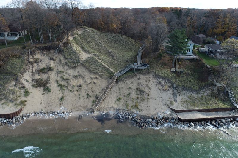
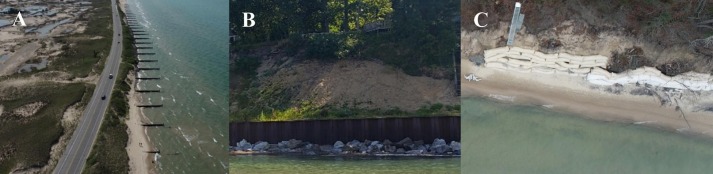
For home- and business owners, as well as lakefront communities, the desire to protect their properties increased. In many instances, coastal property owners responded to these hazards by armoring their shorelines using a variety of hard structures, such as seawalls, revetments, and groins. However, while research shows that these structures may successfully protect an individual location from erosion, they often lead to unintended consequences such as disrupted sediment transport, enhanced coastal erosion of adjacent properties, and negative impacts on ecological communities.
While shoreline armoring is prevalent throughout the Great Lakes region, no studies have documented the changes in the percentage of armoring that results in response to a specific phase of high water levels and its associated effects of coastal erosion. Ethan Theuerkauf, a coastal geomorphologist and assistant professor with the Department of Geography, Environment, and Spatial Sciences at Michigan State University, decided to document the increase of shoreline armoring in response to rising lake levels.
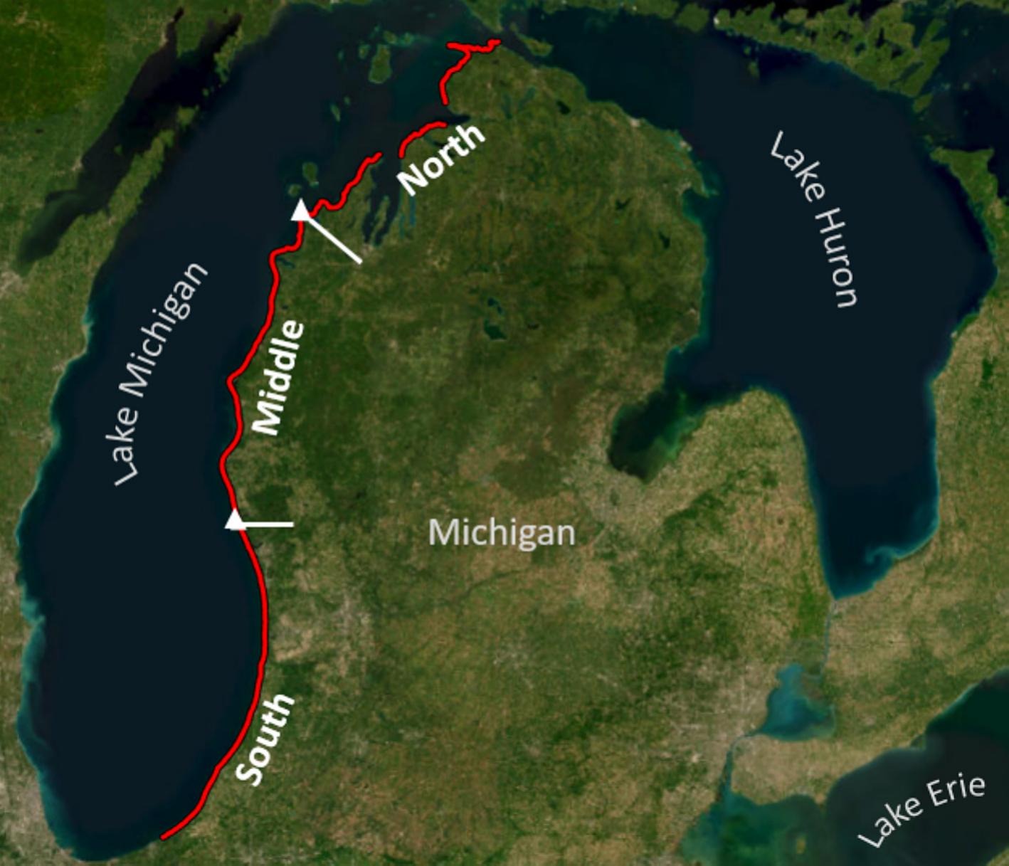
Theuerkauf focused his study on the entire open-coast shoreline of Michigan’s Lake Michigan coast, extending from the Indiana state line north to the Straits of Mackinac, a total distance of nearly 370 miles. The extent of shoreline armoring prior to the high water period beginning in 2014 was determined using datasets through the National Oceanic and Atmospheric Administration’s (NOAA) Office for Coastal Management and digitized coastal imagery from 2014. These datasets were then compared to a 2021 map of armored shoreline, Theuerkauf created using Google Earth Pro.
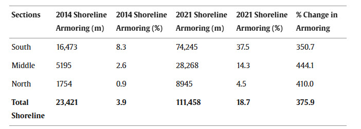
After analyzing the data, Theuerkauf determined that shoreline armoring had increased fivefold during the period of high water levels. The southern section saw the most armoring with an increase of 351% between 2014 and 2021. The middle section had the next highest increase, with 5195 meters of shoreline armoring in 2014 before increasing to 28,268 meters by 2021. The northern section had 1754 meters of shoreline armoring in 2014, which increased to 8945 meters in 2021. In total, the amount of armored shoreline increased 376 % from 23,421 m in 2014 to 111,457 m in 2021.
“We can certainly appreciate landowners’ desire to protect their shorelines. However, since we know that armoring these areas can lead to negative impacts along our coasts, the ability to determine the extent of armoring changes in response to rising lake level is important for guiding policy and management actions,” explained Theuerkauf. “So, despite the protective intent, this widespread armoring raises concerns about its long-term effects on coastal ecosystems and geomorphology, highlighting the need for further research and informed policy decisions to balance protection needs with ecosystem function and integrity.”
Theuerkauf’s study on quantifying the increase in shoreline armoring along Michigan’s Lake Michigan coast associated with rising lake levels appears in a special issue of the Journal of Great Lakes Research focused on coastal processes. Several additional articles related to Theuerkauf’s research are also included in this special issue.