

Drones, phones, and a cryogenic wave tank help researchers uncover new insights into shoreline impacts of Great Lakes ice
January 9, 2024 - Diane Huhn
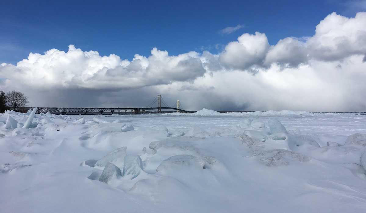
As the calendar marks the start of a new year, most Great Lakes residents reluctantly bid a temporary farewell to the beach months ago, eagerly awaiting the return of sunny skies and warmer temperatures in the spring. And while Ethan Theuerkauf, an assistant professor of geography at Michigan State University, certainly enjoys visiting the shores of the Great Lakes on a lovely summer day, he is welcoming the return of our recent cold weather to continue his research on how lake ice impacts sediment transport and erosion along these freshwater coastal shorelines.
As a coastal geomorphologist, when Theuerkauf arrived at the Department of Geography, Environment, and Spatial Sciences in 2019, he was excited to lead the College of Social Science’s Coastlines and People Thematic Area and add new revelations to the long legacy of Great Lakes coastal research at MSU and other Midwest universities. But he quickly learned that although studies about dune formation, shoreline erosion, and other coastal processes conducted during more temperate months of the year lined the proverbial bookshelves of Great Lakes research, the section on the impacts of nearshore lake ice was pretty much non-existent except for a small handful of studies from the 1970s and 1980s.
Much of this past research essentially concluded that ice serves as a protection mechanism for Great Lakes shorelines. For the last 30 years or so, the general belief was that if ice forms along the shoreline during winter, the shoreline is protected. If ice is not present, more erosion can take place due to wave action. “Turns out it’s far more complicated than that,” explained Theuerkauf. “Ice doesn’t just form and then melt away. It forms and then goes through periods of decay and reformation. Then you have wave action on top of all that. So there are a lot of factors going on that work together to determine what kind of impact ice might have on the shore.”
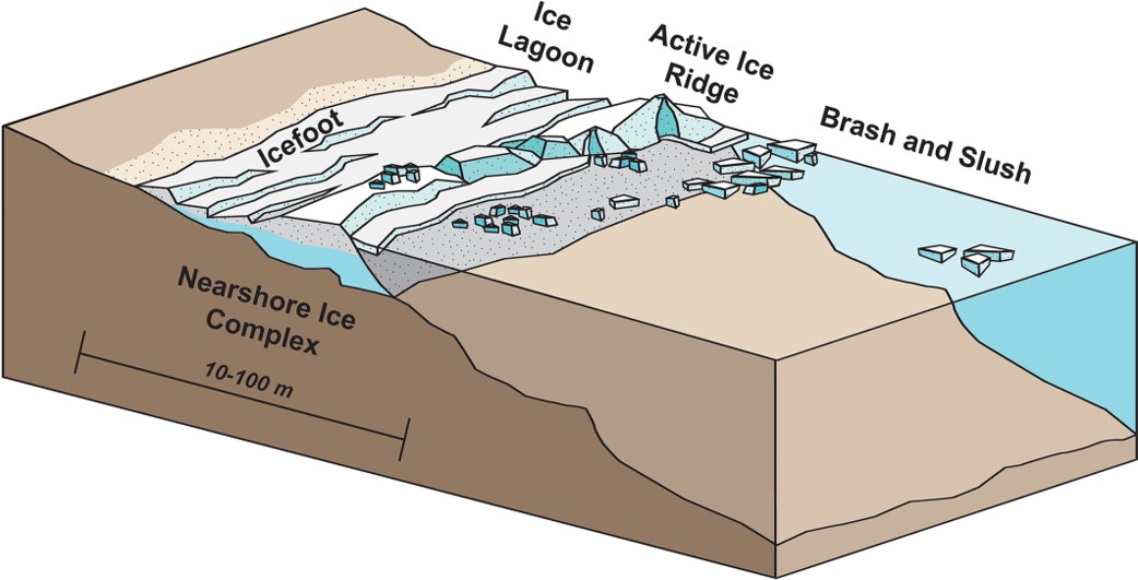
Figure 1 Conceptual diagram of the components of the nearshore ice complex (NIC).
As Theuerkauf and his colleagues started their initial research, which was published earlier this fall in the journal Earth Surface Processes and Landforms, they began to surmise that what’s happening during the ice breakup phase is probably playing the most significant role in what types of impacts can be expected along the shoreline. “It also became clear that it wasn’t just a scenario where large waves appeared at the end of winter, broke up the ice, and that was that,” said Theuerkauf. “It turns out that it’s a lot more nuanced than that.”
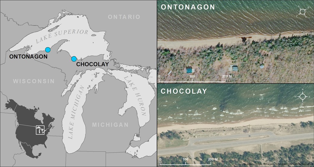
Figure 2 (Left) Study area map depicting the location of the Chocolay and Ontonagon sites within the Great Lakes basin. (Right) Aerial photos of the two sites along the southern Lake Superior coast.
To conduct a first-of-its-kind combined field and laboratory study, Theuerkauf’s team, including two undergraduate students working remotely in the Upper Peninsula of Michigan during the COVID lockdown, bundled up in their warmest winter gear to head to the southern shore of Lake Superior to monitor the beach. Using drones and stationary phone cameras, the team captured important aerial imagery and daily ground-based digital panoramic photos to monitor the ice formation and break up.
The field team’s counterparts on the shores of Lake Mendota in Wisconsin also donned warm clothing, but not because they would be trekking out to an icy lake shore. Under the direction of Lucas Zoet, a Dean L. Morgridge Associate Professor at the University of Wisconsin-Madison, they would actually be spending their time conducting experiments utilizing a custom wave tank they built inside a large walk-in freezer in their lab.
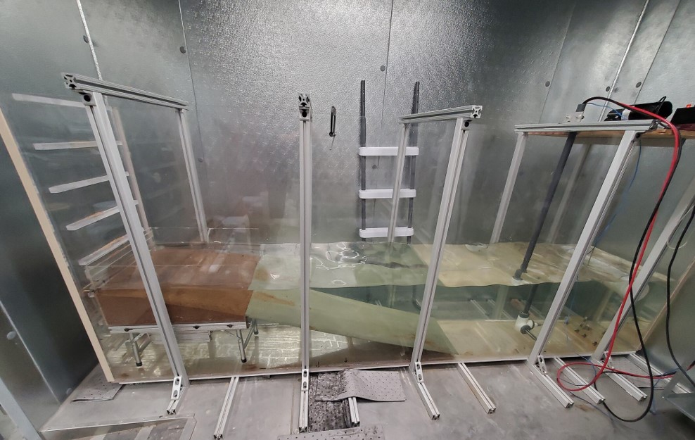
Figure 3 Side profile of the wave tank device. To the left of the photo is the beach ramp and the sediment beach. On the right side of the photo is the plunging wave generator and a heating element. When the tank is in use, cameras are mounted to the overhead aluminum struts. The wave tank is located within a large walk-in freezer.
While wave tanks are used frequently in coastal research, Zoet and his lab members took on the difficult task of constructing the 3x1x1 meter cryogenic tank to simulate winter ice conditions along Lake Superior. Their goal was to determine conditions most favorable for ice breakup and the importance of thermal versus mechanical processes in that breakup process. The results were then used to build a conceptual model of the relationship between the dynamics of nearshore ice breakup and the potential for sediment transport and coastal change.
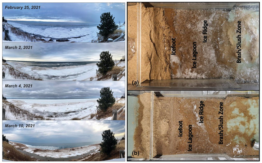
Figure 4 (Left) Panoramic images of initial nearshore ice complex destruction at the Chocolay site from 25 February 2021 through 10 March 2021. (Right) Overhead images of nearshore ice complex development experiments in the wave tank.
When the field- and lab work results were examined, the team determined that the most important factor in how sand gets moved around during ice breakup is the combination of temperature and wave energy. If temperatures remain constant, it isn’t easy to get ice to break up, even with increased wave action. However, given the current climate change predictions, the team believes we may experience increased erosion of Great Lakes shorelines over time because weather conditions will likely become much more erratic. For example, it’s predicted that ice may freeze up more quickly, followed by periods of rapidly rising temperatures and increased winds bringing more intense waves, which in turn will move more sand around, potentially causing increased erosion.
“It’s really a delicate balance between two forces—thermal forces of ice melting and the mechanical forces of waves. If you have a quick warmup, the ice will generally melt in place and leave the sand in place, which is a good thing because that actually promotes beach building,” explained Theuerkauf. “However, if you have more storm energy during the warming phase, which may be the more likely scenario as the climate continues to change, that sand material can get moved around, or even out of, the nearshore system pretty quickly.”
From a scientific standpoint, the work is an essential step in helping to determine how ice should be incorporated into modeling efforts to predict future coastal change in the Great Lakes and other cold coasts. The team is eager to continue their research to understand how these thermal and mechanical processes work together to one day help coastal communities better understand what a changing climate could mean for their shorelines.
To learn more, please visit Nearshore ice complex breakup is controlled by a balance between thermal and mechanical processes.