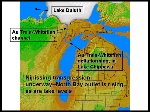
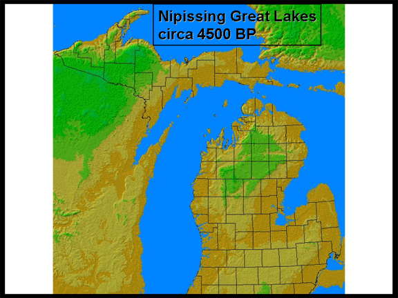
THE NIPISSING GREAT LAKES
The Nipissing Great Lakes are not referred to as "Glacial Lake Nipissing"
because the ice sheet was no longer present in the region. These lakes started
forming as the North Bay outlet opened up, effectively draining Glacial Lake Algonquin down to the Chippewa-Stanley level. With time, from 10,000 BP to about
4500 BP, the outlet rose, due to isostatic rebound. So, as the outlet continued to
rise, lake levels also rose--a period in time referred to as the Nipissing Transgression.
Eventually, the lakes rose to a level that was a few meters higher than current
lake level, and cut a conspicuous notch (beach ridge) into the landscape to mark this high
water stand at 4500 BP.
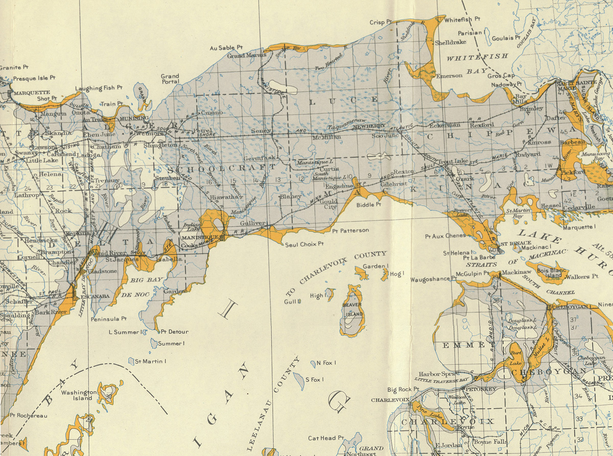
Click for full size image (600K)
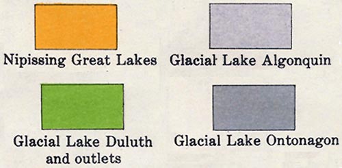 LEGEND
Click for full size image (700K)
This material has been
compiled for educational use only, and may not be reproduced without
permission. One copy may be printed for personal use. Please contact Randall
Schaetzl (soils@msu.edu)
for more information or permissions.